-
{{ item.quantity }}
Melway Releases
Melway Releases
Edition Release and Milestone Dates
1966 Edition 1
First published in 1966 (RRP $2.50)
(every map from edition 1 can be viewed online)
1968 Edition 2
Central City Map
Alternate routes
1969 Edition 3
Postcode Boundaries introduced
House Numbers introduced
10 new maps
1970 Edition 4
11 new maps
1971 Edition 5
O.D. Routes Maps
Increased service index
1973 Edition 6
3 enlarged maps of Melbourne Universities, Enlarged map of VFL Park (now Waverley Park)
1974 Edition 7
45 new maps (4000 new streets) including Mornington Peninsula
1975 Edition 8
Added 750 new streets, 1200 index additions and changes,
3100 amendments, New railway stations Ardeer, Kananook, Yarraman
(RRP $4.95)
1976 Edition 9
20 new maps, 6 new Touring Maps
Introduction of traffic lights to maps
1977 Edition 10
36 new maps including Bacchus Marsh & Geelong
Introduction of Kindergartens and RSL clubs
Census boundaries version published
1978 Edition 11
Taxi & Hire Car introduced
Introduction of Bridges under 4m clearance
1979 Edition 12
Rescaling to metric scale of 1:20,000 together with Australian Map Grid marked on Melway Maps
1980 Edition 13
Introduction of Public Transport Section, Bus Routes shown on all metropolitan maps
1982 Edition 14
12 new 1:10,000 maps of inner Melbourne
Bellarine Peninsula maps added
Bicycle tracks added and indexed
New hierarchy of roads for Melbourne
Won the Inaugural award for Cartographic Excellence, presented by the Australian
Institute of Cartographers
Won the International Cartographic Excellence Award at Moscow Conference 1982
1984 Edition 15
Victorian Arts Centre map
Geelong 1:10,000 enlargements maps
1986 Edition 16
Nine new maps including Warburton maps and a Census Boundaries version published
1987 Edition 17
Fully revised and updated
1988 Edition 18
Large Print Edition first published
1989 Edition 19
28 new maps added including Yarra Glen, balance of Mornington Peninsula and Phillip Island
1990 Edition 20
Central Melbourne Mobility Map
1991 Edition 21
Bus Routes returned to all metropolitan maps
30 new maps including 18 new Touring Maps: Adelaide to Melbourne to Sydney, Australia Map. Telecom Mobilenet maps
1993 Edition 22
36 new Maps & Totally new key maps
Enlarged maps of Dandenong & Frankston, Melbourne Airport enlargement, Central Melbourne Bypass & Access Routes
Springvale and Fawkner Crematoriums
Large Print Edition published for the second time
1994 SYDWAY Edition 1 released
1994 Edition 23
24 new maps: New CENTRAL Key Map; 7 maps to cover Sunbury to Craigieburn. 2 new maps expanding the coverage of Truganina, 5 new maps to complete the continuous map coverage to Healesville. 5 new special purpose maps, Cross referencing of sound-a-like street names added to the street index. New Council Boundaries available at time of printing
Boating Information; Night Rider Bus Service details and map
1995 Edition 24
New Enlarged Melbourne Central Business District Map to show greater detail on maps 1A & 1B
7 NEW maps to complete the coverage from Yellingbo to Pakenham
2 NEW maps between Bacchus Marsh and Melton
CFA & MFB Boundaries. Water and Electricity Authority boundaries overprinted on key maps. Municipal Council Boundaries, Melbourne City Link Project and Western Ring Road
1997 Edition 25
The 1:5000 enlarged Central Business District maps have been expanded with 2 new maps (1C & 1D) to cover the Southbank, Crown Entertainment Complex & Exhibition Centre precinct.
A new comprehensive index to the Central Business District and Southbank is included on pages 21 & 22.
New enlarged maps at 1:10000 now give greater detail of Footscray and Kensington (2S & 2T).
The new Statewide Route Numbering Scheme designations have been shown on all Melway metropolitan and Vicway state maps where implemented. See details on page 3.
1749 new entries have been added to Melway Edition 25 street index (not to forget the 807 entries changed from those listed in edition 24).
1998 Edition 26
24 additional pages of new maps and information
NEW map coverage of the GREATER GEELONG REGION (14 new maps covering the region, and the pre-existing 14 maps have been totally re-drawn!). Extended coverage of Mernda and Doreen, Transurban Citylink detailed guide including toll system details, CityLink alignment and proposed toll points
Docklands Precinct Boundaries
1597 new entries have been added to Melway Edition 26 street index (not to forget the 4502 entries changed from those listed in edition 25).
Every map fully revised.
1999 Edition 27 (for year 2000)
CityLink e-tag, tollpoint and information shops
Exhibition Street Extension across the railyards to Batman Avenue
Northern Ring Road linking up with the Western Ring Road at the Hume Highway. NEW Suburb Boundaries as gazetted since February 1999 are shown on all maps
Docklands Precinct showing major road alterations and new public transport routes
2 NEW MAPS & St.Kilda enlargement on maps 2N and 2P
There are 4767 more entries , and we changed 6008 entries in the street index. Many of these changes are due to the new official suburb boundaries which will assist emergency services respond more efficiently.
Every map fully revised.
2000 Edition 28 (for year 2001)
NEW coverage to Point Cook, EXPANDED coverage of Bacchus Marsh & Melton
OFFICIAL suburb names and boundaries
POSTCODE boundaries as aligned with new suburb boundaries
University of Melbourne and RMIT University new city campus maps
CBD hook turn intersection map
Docklands Precinct updated along with Metropolitan Parks attractions
There are 2031 more entries in the Melway Edition 28 street index.
Every map fully revised.
Every map Computer Generated & we have entered a new generation of accuracy and quality digital imagery
2001 Edition 29 (for year 2002)
29 NEW MAPS: Full coverage of the Bellarine Peninsula to cater for developing areas.
2 new maps provide expanded coverage of Werribee. The official gazetted name shown on Melway maps, many unofficial names included in Index of Localities to assist you. POSTCODE boundaries realigned to coincide with suburb boundaries as required.
CBD hook turn intersection map
Dog prohibited areas shown on maps
There are 1614 more entries in the Melway Edition 29 street index.
Every map fully revised
Large Print Edition !
November 2002, Melway moved to 32 Ricketts Rd, Mt Waverley
2002 Edition 30 (for year 2003)
24 additional pages
17 NEW MAPS including NEW Queenscliffe enlargement, NEW maps of Nar Nar Goon & Tynong
7 NEW maps extend coverage from Sunbury to include Mickleham, Kalkallo & Donnybrook
NEW maps increase Tarneit & Wyndham Vale coverage
Torquay coverage expanded to 4 maps
NEW map of Lorne, NEW bicycle facilities map
Federation Square map
There are 1692 more entries than in the Melway Edition 29 street index.
Every map fully revised
Large Print Edition !
2003 Edition 31 (for year 2004)
NEW Box Hill enlargement
NEW Moonee Ponds enlargement
CBD mobility map extended to include Victoria Market, Museum & Exhibition Building
Fruit Fly boundaries on maps 613 & 630
Marine Parks and boundaries. Melway maps show government designated areas
Selected electricity transmission pylon numbers now included
Shared bicycle road routes
GPS compatible WGS/MGA grid
New headings make the Community Services Index even easier to use
There are 1621 more entries than in the Melway Edition 30 street index.
Every map fully revised
2004 Edition 32 (for year 2005)
12 NEW MAPS covering Wollert, Eynesbury, Mount Cottrell & Maryknoll
MITCHAM-FRANKSTON PROJECT & maps fully detailed with entries & exits
HUME FREEWAY & CRAIGIEBURN BYPASS
AVALON AIRPORT & access, expanded terminal facilities & parking
Fruit Fly boundaries on maps 613 & 630
Marine Parks and boundaries. Melway maps show government designated areas
Bicycle paths and shared road routes
GPS compatible WGS/MGA grid
Over 4700 cross referenced street listings
There are 1407 more entries than in the Melway Edition 31 street index
Every map fully revised
Large Print Edition !
2005 Brisway FIRST EDITION (released May 11)
2005 Edition 33 (For year 2006)
NEW hierarchy of roads
NEW maps covering Mt. Duneed on the Bellarine Peninsula
NEW maps Pakenham South & Rythdale
Detailed public transport routes & train, tram & bus
Bicycle paths & shared road routes
EASTLINK fully detailed
New Craigieburn Bypass
GPS compatible WGS/MGA grid
Over 4700 cross referenced street listings
There are 1391 more street entries than in the Melway 32
Every map fully revised
2006 Edition 34 (For year 2007)
Totally revised and updated with over 1300 additional street listings.
New and extended maps covering Wallan, Arthurs Creek, St Andrews and Kinglake
The most comprehensive public transport routes & train, tram, bus, walking and bicycle tracks
Eastlink & Fully detailed
Victoria Racing Club & Flemington Enlargement Included
GPS compatible WGS/MGA grid
Every map fully revised
2006 23rd November & Updated Website Launched
2007 Edition 35 (For year 2008)
Totally revised and updated with over 730 additional street listings.
New and extending the Gisborne and Wallan areas
The most comprehensive public transport routes information
Train, tram, bus, walking and bicycle tracks
Eastlink & Fully detailed
Victoria Racing Club & Flemington Enlargement
GPS compatible WGS/MGA grid displayed
This edition is also available in LARGE PRINT format
Melway Eway Electronic street directory now available
2008 Edition 36 (For year 2009)
Totally revised and updated with over 1380 additional street listings
Full EastLink Coverage including detailed mapping of Interchanges
Petrol Stations now marked as an icon on the Melway Coverage
Fixed Speed and Red Light Camera locations all marked
The most comprehensive public transport routes information
Train, tram, bus, walking and bicycle tracks
Victoria Racing Club & Flemington Enlargement
GPS compatible WGS/MGA grid displayed
This edition is also available in LARGE PRINT format
Eway Electronic Melway Street Directory now available
2009 Edition 37 (For year 2010)
Wholly produced and printed in Australia
Totally revised and updated with over 600 additional street listings
Two new maps covering Beveridge Township
New suburb Botanic Ridge in the South Cranbourne area included
Full EastLink coverage including detailed mapping of Interchanges. Full coverage of the new section of the Western Freeway (Deer Park bypass)
Proposed Peninsula Link shown in full
Petrol Station locations, Fixed Speed and Red Light Camera positions
The most comprehensive Public Transport Routes information & Train, Tram & Bus
Walking and Bicycle Tracks
Victoria Racing Club & Flemington Enlargement
GPS compatible WGS/MGA grid displayed
2010 Edition 38 (For year 2011)
Wholly produced and printed in Australia
Totally revised and updated with over 1300 additional street listings
140 new and expanding housing estates
Detailed coverage of the proposed Outer Ring Road and Railway, complete with interchanges
Addition of Exit Numbering on the M1 (Princes, Westgate & Monash Freeways)
Wyndham Harbour marina and residential development (currently under construction)
Full CityLink, EastLink and proposed Peninsula Link coverage
Petrol Stations marked as a symbol in the Melway coverage area
Fixed Speed and Red Light Camera locations
The most comprehensive public transport information, with detailed, train, tram & bus routes
Walking and Bicycle Tracks
Victoria Racing Club & Flemington Racecourse Enlargement
GPS compatible WGS/MGA grid displayed
2011 Edition 39 (For year 2012)
Wholly produced and printed in Australia
Totally revised and updated with over 2300 additional street listings
500 revised and updated maps
160 new and expanding housing estates
New coverage of Macedon, Mount Macedon, Riddles Creek and Bannockburn
Newly proposed Westlink connection to Dynon Rd, Kensington to the Western Ring Rd at Sunshine West
The Anthony & Cutting Bypass section of the Western Freeway
The most comprehensive public transport information, with detailed, train, tram & bus routes
Walking and Bicycle Tracks
Victoria Racing Club & Flemington Racecourse Enlargement
GPS compatible WGS/MGA grid displayed
This edition is available in LARGE PRINT format
2012 eway Electronic Melway Street Directory now available
Melway App iPhone app launched
2012 Edition 40 (For year 2013)
Totally revised and updated with over 1000 additional street listings, 500 revised and updated maps, 100+ new and expanding housing estates. The completed link between the Geelong Ring Road and Princes Hwy, Newly proposed link between the Surf Coast and Anglesea Road; New suburbs in Geelong of Armstrong Creek and Charlemont. The most comprehensive public transport information, with detailed, train, tram & bus routes. Walking and Bicycle Tracks, Victoria Racing Club & Flemington Racecourse Enlargement. GPS compatible WGS/MGA grid displayed. Wholly Australian Owned
2013 eway Electronic Melway Street Directory now available
iMelway iPhone & iPad app launched
Commemorative 1966 First Edition Melway Released
2013 Edition 41 (For year 2014)
Edition dedicated to the Founder of Melway, Merv Godfrey OAM
Totally revised and updated with over 1000 additional street listings. 500 revised and updated maps. 150+ new and expanding housing estates. New coverage of Kilmore. The most comprehensive public transport information, with detailed, train, tram & bus routes. Walking and Bicycle Tracks; Victoria Racing Club & Flemington Racecourse Enlargement
GPS compatible WGS/MGA grid displayed
Wholly Australian Owned and This edition is available in the new Melway Mini size plus the popular LARGE PRINT format 2014 eway Electronic Melway Street Directory update available
2014 Edition 42 (For year 2015)
Totally revised and updated with over 900 additional street listings
500 revised and updated maps plus New coverage of Koo Wee Rup plus the construction of the Koo Wee Rup bypass road. The proposed route of the new 18 kilometre tolled freeway-standard East-West Link is shown. The most comprehensive public transport information, with detailed, train, tram & bus routes. Walking and Bicycle Tracks, Victoria Racing Club & Flemington Racecourse Enlargement
GPS compatible WGS/MGA grid displayed, Wholly Australian Owned
2015 eway Electronic Melway Street Directory now available
2015 Edition 43 (For year 2016)
Totally revised and updated with over 900 additional street listings
500 revised and updated maps and Includes the proposed West Gate Distributor. The proposed connection of Collins Street to Port Melbourne. Also includes the proposed Melbourne Metro Rail Tunnel with its five new stations: Arden, Parkville, CBD North, CBD South and Domain. The most comprehensive public transport information, with detailed, train, tram & bus routes. Walking and Bicycle Tracks, Victoria Racing Club & Flemington Racecourse Enlargement. GPS compatible WGS/MGA grid displayed.
Wholly Australian Owned and this edition is available in LARGE PRINT format. 2016 eway Electronic Melway Street Directory now available
2016 Edition 44 (For year 2017)
Celebrating 50 Years: 1966 - 2016
Totally revised and updated with over 1100 additional street listings
500 revised and updated maps, Includes the proposed West Gate Distributor The proposed Melbourne Metro Rail Tunnel from South Kensington railway station to South Yarra railway station Five new stations, the proposed names being Arden, Parkville, CBD North, CBD South and Domain. The most comprehensive public transport information, with detailed, train, tram & bus routes. Walking and Bicycle Tracks and Victoria Racing Club & Flemington Racecourse Enlargement. GPS compatible WGS/MGA grid displayed
Wholly Australian Owned and this edition is available in LARGE PRINT format. 2016 eway Electronic Melway Street Directory now available on a USB key
2017 Edition 45 (For year 2018)
Totally revised and updated with over 2600 additional street listings
500 revised and updated maps, Includes the proposed West Gate Tunnel, Construction has begun on the Melbourne Metro Rail Tunnel
12 New Suburb Listings have been added: Aintree, Bonnie Brook, Capel Sound, Cobblebank, Deanside, Fieldstone, Fraser Rise, Grangefields, Harkness, Strathtulloh, Thornhill Park and Weir Views. GPS compatible WGS/MGA grid displayed. Wholly Australian Owned and this edition is available in LARGE PRINT format
2017 eway Electronic Melway Street Directory now available on a USB key
2018 Edition 46 (For year 2019)
Totally revised and updated with over 1000 additional street listings, 500 revised and updated maps. Includes numerous updates across the vast area of Melbourne.The most comprehensive public transport information, with detailed, train, tram & bus routes. Walking and Bicycle Tracks GPS compatible WGS/MGA grid displayed. Wholly Australian Owned. This edition is available in LARGE PRINT format and the 2018 eway Electronic Melway Street Directory now available on a USB key
2019 Edition 47 (For year 2020)
Totally revised and updated with over 2000 additional street listings
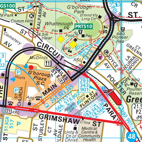
500 revised and updated maps, Includes over 5000 Cross-Referenced Street Listings. This edition also includes the Railway Crossing Removal Program, Drysdale Bypass, Metro Rail Tunnel, North East Link which will link the Metropolitan Ring Road in Greensborough through Watsonia and Macleod to the Eastern Freeway in Bulleen. The most comprehensive public transport information, with detailed, train, tram & bus routes. Walking and Bicycle Tracks GPS compatible WGS/MGA grid displayed. Wholly Australian Owned
2019 eway Electronic Melway Street Directory now available to download after payment at www.melway.com.au
2020 Edition 48 (For year 2021)
Totally revised and updated with over 1700 additional street listings. New coverage areas extending Wallan to now include Wandong. Also more maps covering the expanding areas of Tynong and Pakenham.
All maps Fully revised and Updated with another Melway LARGE PRINT Edition released.
2022 Edition 49 (For year 2023)
Totally revised and updated with over 1350 additional street listings. All maps Updated covering areas which extend from Melbourne to Geelong, Healesville, Kinglake, Wallan, Wandong, Gisborne, Bacchus Marsh, Pakenham and Portsea.
Also released is another (always popular) Melway LARGE PRINT Edition.
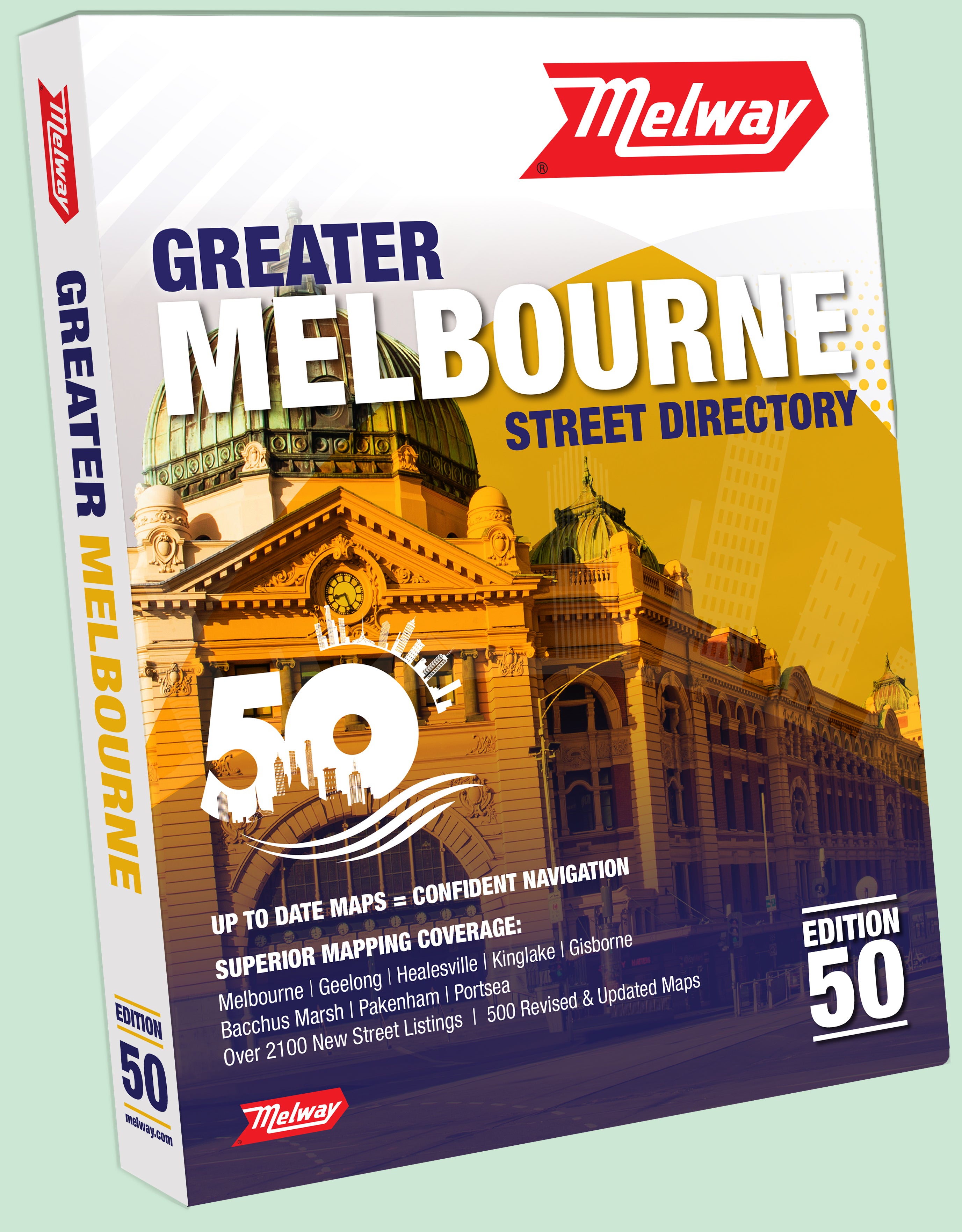
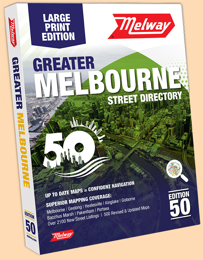
2023 Edition 50 (for year 2024)
Totally Revised and Updated with over 2100 New Street Listings. All maps Updated covering areas which extend from Melbourne to Geelong, Healesville, Kinglake, Wallan, Wandong, Gisborne, Bacchus Marsh, Pakenham and Portsea. A new map 686 has been added to include the continuing expansion of Mickleham. New, current and Proposed Government Major Projects including the Railway Crossing Removal Program, the under construction Pakeham to Koo Wee Rup Bypass, Metro Rail Tunnel, West Gate Tunnel, North East Link which will link the Metropolitan Ring Road in Greensborough to the Eastern Freeway in Bulleen. Also included is the Frankston to Box Hill proposed alignment of the underground outer suburban rail loop.
Also released is another (always popular) Melway LARGE PRINT Edition.


